|
|
 |

|
|
About 14km, About 4hrs.: From Ise-jingu Shrine(Naiku) to Tamaru Station
--- easy walk |
|
|
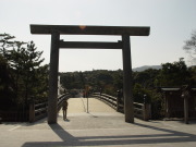
Ise-jingu Shrine is the special shrine dedicated to Amaterasu-Oomikami.
Visiting Ise-jingu Shrine is called "Oise-mairi." It was so popular
in Edo era, many people were eager to visit Ise. Still now, it's popular
travel in Japan. Pilgrims started their trip to Kumano after they vistited
Ise-jingu Shrine.
Along this trial, there are many shrines and historical sites and you can
enjoy them. Because most of the trail is even with paved road, it's easy
hiking trail. |
| "From Naiku to Tamaru trail" brief Map |
|
 click a map and you can see a big PDF map for printing click a map and you can see a big PDF map for printing |
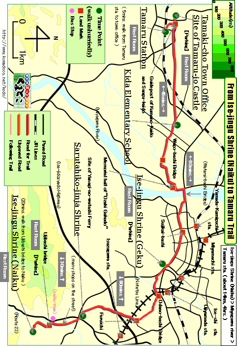 |
| Ise-jingu Shrine(Naiku) ->(even, paved road, 30mins.)-> Sarutahiko-jinja Shrine ->(uphill and downhill, paved road, 90mins.)-> Ise-jingu Shrine(Geku) ->(almost even, paved road, 80mins.)-> Shirota Elementary School ->(almost even, paved road, 45mins.)-> Tamaru Station |
|
|
| by car |
Nagoya ==(Highway / 2hrs. and 10mins.)== Naiku(Ise City) |
| by train and bus |
>Nagoya Station ==(Limited Express(Kintetsu Line) / 1hrs. and 20mins.)==
Ise-shi Station ==(Local Bus / 20mins.)== Naiku-mae Bus Stop
>Nagoya Station ==(Local (JR Line; Kaisoku-Mie) / 1hrs. and 30mins.)==
Ise-shi Station ==(Local Bus / 20mins.)== Naiku-mae Bus Stop |
|
|
|
 |